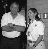
| Tracy Jeffs and Sally Wisely discuss the San Rafael during a break between sessions of the resource forum. |
The resource forum entitled “What’s so Swell about the San Rafael Swell was held on Sept. 19 and 20 at Emery High in Castle Dale.
Participants were welcomed to the session by Sally Wisely, Utah Director of the Bureau of Land Management. Emery County Commissioner Randy Johnson and Wes Curtis from the Governor’s Rural Partnership also addressed the audience. Wisely introduced a Swell project overview and video which showed the outstanding features of the Swell. Such features as Broken Cross, Eagle Canyon, Dutchman Arch, Window Blind Peak, Swasey’s Cabin, Black Box, Wedge, Rochester Panel, Assembly Hall Peak, Cleveland/Lloyd Dinosaur Quarry, San Rafael Reef, Wild Horse Canyon, Muddy Creek, Temple Mountain, Family Butte, Hondoo Arch, Sid and his dog, San Rafael Reef, just to name a few.
Wisely said, “That’s quite a back yard you have. The second question is what should we do about it. We are in the middle of a community dialogue process, which is recognized as being special. President Bush asked Secretary of the Interior Gale Norton for feedback on the San Rafael Region and to inventory objects of interest and information relevant to develop plans for management in an open and inclusive process.
“It made more sense if we all worked together, the state, BLM and the county. To develop a partnership and go through the specific steps to provide information and gather input about the wealth of resources and cultural history of the Swell. The report will be complete by the end of November. The website that has been set up to provide information and it is the best place to track the process and it is easily accessible and interactive. We all know the best way to get to know an area is to experience it first hand and we will do this through a series of guided field trips.
“The week of Nov. 18 we will host a series of open house meetings which will be a great opportunity to provide input in how we believe these lands should be used. The results of the survey will be available in January. There are a lot of processes going on, the resource management plan as well as wilderness study area processes. There is a lot happening. We thought it was best to involve the people in the San Rafael process. From a BLM prospective the San Rafael is significant, the information gathering will help in the determination if this is a nationally significant region and does it warrant Monument status or other protection?
“The best way to do this is through an open dialogue, the goal is not whether we are for or against….but, just to put the information on the table. The report will be sent to Secretary Gale Norton in the spring and forwarded to the President. BLM will not make a recommendation, but gather the information and pass it on the President. Regardless of the decision, the bottom line is this is our backyard and we need to figure out how to manage its future with formal land use policy. We still need to address the needs of the area. The resource management plan for the Price field office includes the Swell.
“Seeing that the Swell is protected and enjoyed deserves our best effort, it deserves the best we can come up with and it takes all of us to come up with a plan; an opportunity to focus. Whether we are for or against…..don’t lose this opportunity to decide how it should be managed to our best advantage and to the advantage of those future generations,” said Wisely.
Participants broke into separate sessions which specifically looked at one of the Swells features or historical components. Sessions included: Edward Geary, history of the human experience on the San Rafael Swell, Jim Talbot, geology, Rob Heille, special management approaches and trends, Greg Fausett, The cold war and the San Rafael Swell; the MK tunnels, Jim Evans, geology of the Swell. Friday night sessions included, Jeff Durrant, ranching in the modern Swell, Bill Bates, threatened and endangered species of the Swell, Ramal Jones, paleontological research tools developed in the Swell, Tom Gnojek, recreation as a modern use of the Swell and Susan Miller, archeology of the I-70 corridor.
The next step in the information gathering process is the field tours. On Sept. 21 the first of the tours began with tour guides, Mike Leschin, Wayne Ludington and Tom Gnojek. On Oct. 5, Wayne Ludington will lead the tour on ecology, flora and fauna, On Oct 12, paleontology, archeology and geology will be led by Mike Leschin, On Oct. 19, modern uses will be led by Tom Gnojek, and Oct. 26, history, mining, pioneer and ranching heritage by Ruth McCoard.
Tours are free to the public and no reservations are required but an RSVP is requested to 435-636-3600. Participants need to provide their own transportation, food and water.