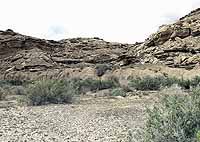
| The South Moore cutoff road will be realigned to come off this ledge which will take a blind curve out of the road. |
A project that has been talked about since I-70 was built during the 1960s is beginning to take shape and make its way from the drawing board to the bulldozer. The South Moore cutoff road environmental assessment has been completed and concerns addressed and the project is ready to go out for bid within the next month. The state will begin the bidding process and is the facilitator for the project. It will be released for bid statewide.
Rex Funk who is the department head of the Emery County Road department said, “This is a long term project and we are in Phase one of that project now. Phase two will begin on the I-70 side of the Moore cutoff road where it comes off the freeway. Phases three and four will divide up the remaining portion of the project that lies between phases one and two. Phase five and six will pave the newly constructed road. Phase seven will include the reconstruction of the existing paved section from the Moore intersection to where it connects to SR-10.
| This blind curve will be bypassed with the new alignment. |
“The project will take anywhere from 20-30 years and will be built as funds become available. The funds are coming from the non-urban fund of the Federal Highway Administration. It was talked about in the 60s when I-70 was completed, in the construction of interstates funds were made available for connector roads to those interstate systems. This road has been neglected in that connector system,” said Funk.
Funk said the first phase of the project will complete approximately five miles of the 20 mile shortcut, maybe farther as funds allow. The improvements to the road will eliminate substandard curves and other alignment problems and provide a safer, all-weather travel surface and promote a pathway for future economic development of the county. This road provides an important link to I-70 as well as to the San Rafael Swell. The road has approximately 100 vehicles traveling it each day. These include tourists, ranchers, motor homes, cars and ATVs. Sometimes winter or summer storms will make the road impassable and dangerous. The reconstruction project will follow the American Association of State Highway and Transportation standards for a rural collector road. An environmental analysis was conducted and areas of special resource values were identified within the area of disturbance. There were several issues raised by the internal and public scoping process. These issues include threatened and endangered plants, raptor nesting, cultural resources, nearby wilderness study areas, safety for travelers and livestock, recreation, erosion and dust control, tourism, local transportation, economics, preservation of the scenic values and character of the area, speeding and questions regarding the need for the road improvement. In addition to the public scoping process, the BLM also addressed their concerns on potential impacts.
| Rock art and other sites of archaeological significance will be preserved or relocated. |
The archaeological and paleontological sites of interest or concern will be undisturbed or relocated. Access to active mining claims and to two reservoirs in the area which serve as stock watering ponds in the area will also be maintained. Stretches of the abandoned sections of road will be reclaimed and sections which lead to access to important features will remain in their present state. Funk pointed out that rock art in the area of the realignment will not be disturbed. He said the blind curves have been the site of accidents and many near misses through the years.