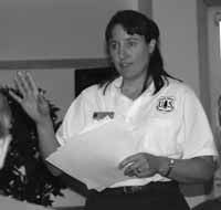
| Elaine Alexander talks about wild and scenic rivers on the forest. |
It’s your forest, do you want a say in how it’s managed? Just an opportunity was given recently at the public meeting held at the Museum of the San Rafael on May 13. Ann King, public affairs officer for the US Forest Service said the purpose of this meeting was to receive comments from the public concerning the forest plan revision. Forest plan revision began in 2003, with meetings to hear from the citizens concerning their wants and needs for the forests.
The new forest plan is taking shape. Three items were discussed at this public meeting with a directive for multiple use. The last revision of the forest plan took place in 1986. Since that time, laws have changed concerning the forest and trends have changed concerning use of the forests.
Following the 2003 meetings, the forest service read every comment from the public and made a draft revision plan. That draft was the focus of the evening. “This plan is only tentative and we need input from you,” said King. “Tonight we will discuss three of the areas. Those are needs for change, wild and scenic rivers, and roadless/wilderness area.”
King said it is crucial to receive all comments about needs for change by June 1. The deadline for comments on wild and scenic rivers and roadless/wilderness will be July 15.
In determining the needs for change, a five step process was initiated to identify the needs for change in management direction on the forest. An extensive review of forest monitoring, evaluation reports, existing legislation, regulations, policy, existing conditions, the 1986 plan and public comments from the 2003 meetings.
The five major topics to be tentatively identified are recreation, ecosystem management, watershed health, transportation system and fire/fuels management. If there is an area, in your opinion, that also needs change, comments are required to be submitted to Forest Plan Revision Team, c/o Heber Williams, Manti-LaSal National Forest, 599 West Price River Drive, Price, UT 84501 by June 1.
Elaine Alexander was next to answer questions concerning the drafted plan for wild and scenic rivers. She began by stating that the process of designation of wild and scenic rivers is now in the second phase which is suitability. When the eligibility process began, all the rivers in Utah forests were on that list. Through the elimination of those rivers that are not eligible, only 14 river segments are on the suitability list in Utah. There are three river segments in Emery and Carbon counties.
The suitability phase of this process basically answers two questions. First, what is the best use of the river corridor? Should the outstanding values be fully protected, or are one or more other uses important enough to warrant not maintaining the river’s free flowing or fully protecting values?
The second question is, assuming the values are to be protected, what is the best method to protect the river corridor? Wild and scenic river designation is one approach. In answering this question, the benefits and impacts of WSR designation must be evaluated and alternative river protection methods considered.
For the Manti Division-Ferron/Price Ranger District, the lower left fork of Huntington Creek, Huntington Creek, and Fish Creek in Carbon County, are being considered for wild and scenic designation.
David Gray presented the roadless/wilderness portions of the forest management revision plan. He pointed out that the proposed changes are only in the draft stage and public comment is critical. The five things to take into consideration when determining a roadless/wilderness area are: environment; challenge; outdoor recreation opportunities; special features; and manageability.
Determine the degree to which the area provides visitors with the opportunity to gain a wide range of experiential benefits such as a feeling of solitude and serenity, a spirit of adventure and awareness, and a sense of self-reliance. Determine the degree to which the area offers visitors the opportunity to experience adventure, excitement, challenge, initiative, or self-reliance. Determine the area’s capability of providing primitive and unconfined types of recreation such as camping, hunting, fishing, mountain climbing, ski touring, canoeing, boating, river rafting, backpacking, hiking, riding, photography and other outdoor activities. Describe the roadless/wilderness area’s capability to provide outdoor education and scientific study, both formal and informal, that is compatible with wilderness. In determining capability, consider the ability to manage the area as wilderness as required by the Wilderness Act.
As one considers the previous elements of the areas proposed for wilderness designation, also consider the boundaries of the area. In most desirable situations, boundaries: avoid conflict; are accurately described and marked; conform with terrain; shield and protect the area; and provide adequate opportunity for access and traveler transfer facilities.
Three of the areas being considered for roadless/wilderness designation are Black Canyon, Hole Trail, and Wagon Road Ridge.
Any comments from the public concerning the three river segments in the suitability phase of wild and scenic river designation, or the roadless/wilderness areas, should be submitted by July 15. All the draft reports can be read and forms for submitting comments can be found at the following websites: www.fs.fed.us/r4/mantilasal/projects/, www.fs.fed.us/, www.fs.fed.is/im/directives/, ipl.unm.edu.cwl/fedbook/nfma.html, www4.law.cornell.edu/uscode/16/1131.html, or www4.law.cornell.edu/uscode/16/1271.html. Email comments can be made to: comments-intermtn-manti-lasal@fs.fed.us. Letters can be addressed to: Manti-LaSal National Forest, attn. Heber Williams, 599 West Price River Drive, Price, UT 84501.