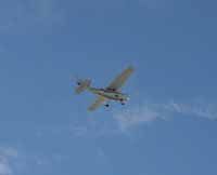
| This plane flown by Randy Jones of St. George uses the Huntington Airport. |
Emery County is making plans for the future of the Huntington Airport. Jones and Demille Engineering of Richfield recently prepared a Huntington Airport Layout Plan and presented it in a public hearing on Jan. 18 at the county building in Castle Dale.
John Spendlove presented the information in the draft report. Commissioner Ira Hatch outlined the reason behind the new plan. “We have been aware for sometime that improvements were needed at the Huntington Airport,” said Hatch. He said a long range plan is needed to qualify for state and federal grants. Funds have been acquired recently for improvements to the lighting and the apron at the airport. The plan outlines where the county wants to go and what they would like to accomplish at the airport facility.
The plan is now open to public comment until Feb.15. This public input will be considered in the final draft of the plan.
A complete inventory was taken of what actually exists at the airport. Spendlove reported there are three runways at the airport with 4,000 feet of paved runway available. An apron exists with eight tie downs and tie downs are also available in front of the hangars. There are two paved taxiways and one dirt taxiway. There is a terminal building and three hangars and a home where in the past the airport manager resides. There are miscellaneous facilities as well including a weather station, fuel tanks and runway lights. The elevation at the Huntington Airport is 5,915 feet. The Huntington Airport was first established in the early 50s. On Aug. 23, 1951 the BLM issued a land lease to Huntington City for use of BLM land for the airport. The airport was originally owned and operated by Huntington City. On June 28, 1978, Huntington City transferred title and interest in the airport to Emery County.
The airport contains a total of 3,338 acres of land, most of which is leased from the BLM. The county is currently working with the BLM to have the patent on the leased land deeded to the county. This action is being addressed in the real estate section of the current resource management plan which is now in the review stage by the BLM. The county owns 13 acres at the airport.
| Randy Jones readies for takeoff from the Huntington Airport. |
The plan also looked at aviation activity at the airport. In 2003, there were 4,800 annual operations which consists of takeoffs and landings. Hatch also noted that there were two airport managers during the study period on the airport.
The airport is currently without a manager with the last manager, Rob Midgely, moving on to a teaching position in Utah County. The county has been advertising to fill the position and talking to interested parties.
The report listed the main airport users as the county sheriff’s office, national guard, fire crews and private pilots. Figures also listed numbers of airplanes based at the facility and projected numbers for the future dependent on the construction of additional hangars to accommodate these aircrafts. In 2003, there were three aircrafts based out of Huntington Airport, in 2008 projections are nine, in 2013-10 aircraft, 2018-11 aircraft and 2023-12 aircraft.
A 30 percent growth is projected from now until 2008 afterwhich it levels off at 2 percent growth.
Aircraft are given airport reference codes with the smallest being A-1, these codes are given based on the wing span of the aircraft and the runway approach speed. Future plans include being able to accommodate B-2 aircraft at the facility. The runway length for a B-2 aircraft is 5,150 ft. The current runway would be expanded by 1,100 feet to support B-2 aircraft. Passenger planes with a less than 10 passenger capacity can utilize a runway of this length. Planes with more than a 10 passenger capacity need a runway of 7,300 feet, a runway of this length is not being considered at this time.
| Pat Jones and Randy Jones push the airplane towards the hangar. |
The alignment of the runways was also looked at and evaluated. The line of sight on the runways was also evaluated, you should be able to see from one end of the runway to the other. The current taxiways at the airport are adequate for A-1 and B-2 aircrafts. The runway safety areas were addressed, the safety area is the extended area beyond the runway in case an aircraft ran off the runway. This safety area must be graded and smooth for the safety of any runaway planes.
Runways must also be free of obstructions, trees, fences and other objects. One of the runways has a fence too near and these types of issues will be addressed to bring the safety areas into compliance. The FAA likes the airport to own the runway protection zones and some of the zones at the airport are off airport property. This will also be addressed.
The plan also looked at the airspace surrounding the airport. This space should be as free of objects as possible. There are several concerns with airspace. A vehicle driving down the nearby road could be considered an intrusion into this airspace.
The airport contains several navigational aids, a beacon, runway lights, lighted wind comb and a weather station. Pilots on hand at the public meeting said the weather station is not of value because it never works. Hatch said it was the one they were instructed to get at the time and they will look into the problems with the weather station. Most landings at the Huntington Airport are not instrumental landings.
The plan also suggests that additional property be acquired at the end of runway 26 for the runway protection zone for a future extension.
| The terminal building at the airport. |
In the planning efforts from now until the year 2021 several improvement projects are planned for the airport. These are to be done in increments which will spread the costs over a period of years. First the safety issues will be addressed during the short term planning. Plans for grading of the safety area, replacing runway lights and land acquisition are on the docket for 2005. Also, hangars will be addressed in 2005. In 2006, the runway and aprons will see a crack seal and seal coat and paint applied. Land acquisition will again be addressed. In 2007, the access road and parking will be looked at as well as relocating the house and removing obstructions. In 2008, the relocation of county road 212 will be addressed.
Intermediate planning includes for 2009-2012- runway crack seal and seal coat and paint, widen and extension of runway 8/26 with a turnaround, access road, phase two of widening and extending runway 8/26 with turnaround. Apron crack seal and seal coat and paint.
Long term planning includes: 2014-2021, terminal building, apron and automobile parking phase II, relocate beacon, runway and apron crack seal and seal coat and paint and hangars.
When the required work has been completed to adequately meet the criteria for the airport to be included in the National Plan of Integrated Airport Systems then the Huntington Airport can be eligible for federal funds. Emery County will work to have the Huntington Airport included in the NIPIAS when it meets the criteria which can be a lengthy process. Improvements can now be funded through the Utah Division of Aeronautics. These funds are a 90-10 percent match. The only projects not eligible for these funds would be the hangars and a new terminal building. Funds for these projects will have to be acquired elsewhere; from private investors and the county.
Pilots using Huntington Airport seem to think an extension of the north/south runway would better serve the airport.
Crosswinds are a problem with the runway slated for lengthening.
Costs for expanding the north/south runway is estimated to be over $1 million due to the amount of fillwork that would have to be done.