This begins a three part series on economic opportunity in Green River and surrounding areas and the efforts taking place to advance economic development.
Green River City is working on developing trails in and around the city. Marcy DeMillion is working with the city on this project. She is from the National Park Service and is a community planner for the rivers, trails and conservation assistance program. Green River Mayor Pat Brady welcomed everyone to the open house on the trails. He said he is ready and anxious for the work to begin on trails surrounding Green River. So far, Mayor Brady said they have completed one mile of trail around Monument Hill. There is also a riverside path at the John Wesley Powell River History Museum. Some University of Utah students prepared a plan and an outline of projects to enhance the museum and the river for visitors to the area as well as local residents. Paths have been cleared to the marks where flood depth of the river can be observed. There are three points that are now accessible.
Green River has a volunteer trails committee that meets regularly to move the project along. “The goal of Green River is to be a destination and not just a drive-by community. All of these projects will help,” said Mayor Brady.
Council member Penney Riches is the chair of the trails committee. She said the committee is very excited and committed to the project. Non-motorized trails where people can walk, run and ride horses are what they have in mind. They are in the planning stages now to see what types of trails people want and will support. They are also working on funding for trails. The committee wants a lot of community involvement and input. Tim Smith, the regional director for state parks said that the city could also use the 40 acres of state parks land originally intended for another nine holes at the Green River Golf Course.
Maps were set-up in the room for participants to mark where they feel trails should be placed around the city and surrounding areas.
They were instructed to avoid marking trails across private lands where more than two land owners would be involved. Gaining permission and access on private lands can be a problem. SITLA and Bureau of Land Management lands are more workable. Participants also took a trails survey to give information on where trails should be located and what types of trails should be utilized. Paved trails which are stroller and family friendly are the most costly.
DeMillion said she has met with the trails committee and they are developing goals and visions for the trails. An inventory of the existing city parks is also being completed.
In the near future a complete trail plan and map will be available. Once this is prepared the committee can apply for grants.
The vision of the trails committee is to create a non-motorized trails system to be utilized by locals and tourists alike. The committee wants to create the first water trail in Utah. By developing these trails economic opportunities and development can be reached.
When visitors come and spend an extra day more money will flow into the local economy. By creating these trails the people of Green River have the opportunity to become more healthy by using the trails for exercise opportunities. The Green River Medical Center receives small grants they would like to donate towards these trails to promote healthy lifestyles.
Trails committee member LaMar Guymon said he has been involved with the bike festival each year in Green River. He would like to see additional trails developed to add variety to this event. It’s been held the last 26 years and brings visitors to the area. He told of a new area he’s discovered where trails would be appropriate and the slick rock riding there is every bit as good as Moab.
This area is 29 miles south of Green River, lower San Rafael Road, west and north of Saucer Basin road, all that slick rock that goes back north to the San Rafael river could be developed for trails.
The Goodwater Rim Trail has been developed along the rim of the Wedge and it’s been listed in biking magazines as one of the must ride trails in the Western United States. At Your Leisure has filmed a program on the Goodwater Rim Trail.
The BLM has been using GPS to locate and record these trails so they can be added to the BLM trail maps. If the Goblin Valley Expansion takes place this will add opportunities for new trails in that area.
As many as 100 people a weekend come and ride the Goodwater Trail. “All of this adds to our economy,” said Guymon.
Zach Maughan presented information on the types of trails that can be constructed. Dirt and gravel surface trails serve multiple uses including horses, bike, jogging and walking. Trails are rated for difficulty including easy, moderate, difficult and extremely difficult.
A good variety of trails and difficulty levels would be the ideal situation.
Trails can also vary in width. Vegetation is cleared from a trail. Loop trails are great because then visitors don’t have to just go up and then come back. Trails placed by roads should have a buffer zone between the trail and the road.
Maughan said it’s good to utilize connections to open space and destinations including parks and other trails. There is a trail that extends from Ogden all the way to Provo.
He said it’s good to tie historic features into trails. Amenities along trails are great including benches, bathrooms and educational signs and materials.
Trails that are multiple use are the most successful because it adds to the number of users.
Trail users must be respectful of other users. There must be enough parking space at trail heads. Equestrian trails should be wider. Equestrian trails need more vertical clearance so all users can see each other and they don’t startle one another along the trail.
Dirt and gravel trails require less maintenance and are less expensive. Paved trails are the most expensive at $300,000 per paved mile-10 feet in width.
Trails can sustain damage from erosion and locations for trails must be adequately assessed for erosion potential.
Along with the survey the attendees took there were three logos to vote on prepared by the Epicenter employees. This logo will be used on all materials used to promote the trail system.
After all the input and planning of trail locations, the trails committee will seek funding. The trails committee will meet again on Sept. 8 at 1 pm at the Green River City Hall.
Part One: Creating economic opportunity in Emery County The beginning of a trails system in Green River
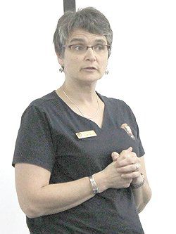
"Marcy DeMillion from the National Parks is helping with the trail committee."