Sally Jewell Secretary of the United States Department of the Interior toured Emery County July 12, with Emery County Commissioner Keith Brady leading the tour.
When Sally Jewell and her staff arrived they were greeted by Emery County Commissioners, leaders of the Public Lands Council, Bureau of Land Management and Forest Service officials and some former County Commissioners as well as other interested members of the government and the community.
Sally Jewell said it was a pleasure to be in Emery County. She has a great job that gives her the opportunity to visit many beautiful parts of the United States.
Commissioner Brady asked Ray Petersen to begin the 45 minute informational meeting held at the Old Emery County Courthouse in Castle Dale. Petersen is the Emery County Public Lands director and he explained how long the Emery County Public Lands Council has been working on the issue of public land use.
He believes they have a good plan for all parties interested in managing the public lands. Petersen used a map of Emery County to illustrate the route the tour would travel through the San Rafael Swell from Castle Dale to the Wedge Overlook, the Buckhorn Pictograph Panel, the Swinging Bridge and the Spotted Wolf Overlook then to Green River.
After reviewing for Sec. Jewell a list of the Public Lands Initiative topics Petersen gave her a tourist 2016 Activities Guide, and a copy of Ed Geary’s History of Emery County.
Petersen then illustrated the map of Emery County which he said represents just under three million acres of land and pointed out 72 percent of the land is owned by Federal Government and most is managed by the BLM. The county and the Public Lands Council has been working on this process of land use planning for about 8 years with the current legislation and 20 years before that on various initiatives. Many different public land user groups are represented on the Public Lands Council.
Petersen pointed to proposed Wilderness Study Areas and three National Conservancy Areas on the Emery County map. He also pointed out the land designated as State Institutional Trust Land. Each part of the map he illustrated were areas the council recommended for change.
This plan would help Emery County and benefit the Federal Government.
Former Commissioner Randy Johnson reviewed the history of how the Public Lands Council was formed and how all entities interested in public lands issues were invited to participate in working out solutions to various issues.
When the tour arrived at the Wedge Overlook they found the McElprang family with their saddle horses looking for cattle grazing in the hills.
After viewing the Wedge Overlook with its magnificent group of canyons, the stream below and the colorful rock walls. Jewell and the group returned to their cars and proceeded on to the Buckhorn Pictograph Panel.
This Public Lands Initiative Bill was introduced in the United States Congress on July 14 by Legislators Rob Bishop and Jason Chaffetz.
Sec. Jewell also visited the Moab area and on Saturday was part of a public meeting held in Bluff. Commissioner Brady attended this meeting in Bluff. Comments were heard from both sides of the Bears Ears National Monument proposal. He said there were 600 people who wanted to make comments at the meeting. The comments were on a lottery system. There were those who supported making the area a national monument and also supporters who would like to see the process of the Public Lands Initiative Bill introduced by Reps. Bishop and Chaffetz move forward.
Secretary of Interior Jewell tours Emery County
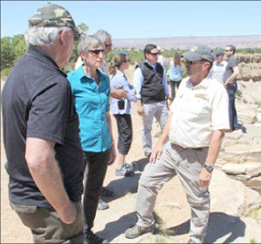
"Sec. of Interior Sally Jewell tours Emery County along with public lands director Ray Petersen and public lands advisor Randy Johnson."