Emery County Historical Society met at the Museum of The San Rafael. The topic presented by Wade Allinson was “The Emery County Influence at Robbers Roost and Under the Ledge, 1890-1940.”
The Historical Society Chairman Evelyn Huntsman opened the meeting by exclaiming, “What a wonderful crowd we have tonight.” “We are so pleased to have you here.” Nearly all the Museum chairs were used to seat the large group.
In March, Wade Allinson will make a presentation about John C. Fremont in the Emery County area.
After a prayer and a pledge to the flag of the United States of America, Evelyn Huntsman announced, new Emery County Historical Society Officers will have to be elected this year in this meeting.
Nominations were taken from the floor for each of the offices in the Emery County Historical Society. The new officers elected are as follows: Joyce Staley Treasurer, Evelyn Huntsman Secretary, Lori Ann Larsen Vice Chairman and Susanne Anderson Chairman.
Past Chairman Dixie Swasey was given the assignment of swearing in the new officers.
Evelyn Huntsman paid tribute to Dixie Swasey for her leadership abilities and dedication to the society over the years.
Suzanne Anderson said they wanted to recognize Evelyn Huntsman and tell her thank you for all the fun things she has brought to the society. Then, Suzanne presented Evelyn Huntsman a large potted houseplant. We are glad she will still be working with us.
At the start of the program, Evelyn introduced Linden Gardner as a special guest entertainer who would play his guitar and sing a few old Western ballads for the group to enjoy. His first ballad was “Ghost Riders in the Sky.” The second ballad sung was “Cool Water” and the third ballad was “Riding Down the Trail When the Desert Sun Goes Down.”
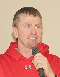
Evelyn Huntsman introduced the guest speaker Wade Allinson, who arrived at the meeting with his wife Jenny Lynn and daughter Maddie and was to tell the group of what he found from his exploring in the Robbers Roost Area of Utah.
Allinson started his lecture by saying, “Most of what I will present today will come from my research and from questions I’ve asked of Emery County people about their ancestors and many of those people are in the audience tonight. I appreciate their input. Tonight, the things I’m going to talk about will be like trying to put a puzzle together.
Many of the families living in Emery County have family histories of having contacts with people down in the robbers roost area and under the ledge. Some of them claim to have made contact with the wild bunch down there. You often wonder how accurate the stories are.
But when you go there and start researching the robbers roost you find the influence of Emery County was amazing. The people from Emery County probably had the biggest influence there as they were raising livestock on that range.
The first time I went horseback riding through poison springs I started to see names on the rocks that tied back to Emery County. I saw the names Petty, Joe Swasey, Mont Caldwell and Wareham. Then I went into a canyon called Trachyte Canyon and noticed the date 1885 and the Joe Swasey name.
Allinson then displayed a map on the screen and pointed out the location of Ferron, Utah and Grand Junction Colo. to illustrate the distances covered by this geographical area. Robbers Roost is not a single place. It is a broad range of canyons part of this area is in Wayne County. Allinson then illustrated the distances Emery County men with livestock had traveled with their herds.” Some of the distances involved are as follows: From Ferron to Hanksville is 129 miles and from Ferron to Hite is 201 miles. The elevation at Robbers Roost is over 6,000 feet. The elevation under the ledge is 5,000 feet. Because of the high elevations snow will remain there until March.
Some of the locations shown on the map were Goblin Valley, Gilson Butte, Poison Springs, Sunset Pass, French Spring, Sams Mesa, Blocks, Robbers Roost Canyon, Water Hole Flat, the Henry Mountains and Trachyte Canyon.
The long line of cliffs from the upper area to the lower elevation, called Under the Ledge, prevented access to that piece of useful grazing. It took some time to figure out how to get livestock down there.
Wade Allinson said he likes to collect the names of old cowboys written on rocks and these are some he has found down in the Robbers Roost area. Emery County’s influence there was primarily from sheepherders. Those names are Crawford, Seely, Snow, Bohleen, Simonsen, Huntsman, Hitchcock, Moffett, Ottesen, Nelson, Sorensen, Swasey, Ihler, Olsen, Petty, Wells, Wareham, Larson, Jensen, Caldwell, Duncan and Jeffs. This is a large snapshot of the names found on rocks and cliffs of families from Emery County at Robbers Roost and Under the Ledge.
The herd size of the sheep would be from 1,000 to 2,000 head. The sheepherder camp consisted of one herder and one tender or mover. The tender would generally make the dinner and move the camp as the herd moved along. They stayed in wall tents. I learned from Ned Chaffin that they ate a lot of rice in those sheep camps. It took to long too cook beans. With rice you could throw a bunch of it in your saddlebags and it wouldn’t rot and it expanded with water. Rice is what they ate. If you go there you will find a lot of condensed milk cans. They would pour condensed milk over the rice. In the winter they would eat some beef, mutton and deer. They would trade with cattlemen for the beef.
Trail development, spring development and the range expansion from the roost to underneath the ledge will be our next topics of discussion.
After the 1930s you see more Wayne County cattle and sheep operations moving in to the area and Emery County people seem to have stopped going there, possibly because the Bureau of Land Management took over in 1939. After the 1940s names from Tory, Teasdale and Hanksville appear.
The North Trail Canyon is near French Springs. Ken Crawford is probably one of the first to make a trail from French Springs down to the North Trail in order to get under the ledge. He is possibly the first to take livestock under the ledge. Ken Crawford was from Ferron and his descendants are living there.
Wade said it was an amazing feat to get livestock down off the ledge to the grass that was under the ledge. Wade quoted Carlyle an author, “After crossing the desert going towards the Colorado River, Ken was on a high mesa near the Colorado River. He looked below and saw some green grass and there was a draw coming from the South that would be North Trail Canyon. He started off some of his goats. He wouldn’t send sheep or any of his mules down there. He was willing to sacrifice his goats. He later followed their difficult path. Where he chipped and blasted the path to make it easier for his sheep, horses and mules. This route is now known as the North Trail.”
Ned Chaffin mentions how difficult it is to get horses down that trail.
Sam’s Mesa is supposed to have been named after Sam Aiken. Sam was from Sanpete County. Sam and Charlie Swasey took several mares and burro jacks to the Mesa for the winter. Some of the names found at the French Springs are Swasey, Moffett, Crawford, Ihler, Seely, Olsen, Christensen, Otteson, Reid, Robertson and Sorenson.
There is a nice spring at Sam’s Mesa and trail right to the spring. The old cowboys wrote their names on the rocks above the spring. Possibly they wrote their name while watering their sheep. There is quite a bit of water that runs out from the spring towards the Dirty Devil River.
My favorite inscription was left by Carl Seely in 1921. Carl was one of the bigger sheep operations. He would run three different herds at one time out there. He later leased his herd to Ez Huntsman. Gunner Ihler was there in 1931, the Bert Moffetts spent some time in Orangeville. Bert Moffetts inscription is dated 1897 and again in 1904.
When you come down off of the Roost from Sam’s Mesa and get under the ledges into the Blocks. Wade showed photos of the red rock ledges or cliffs with names and dates. He pointed out on a map Trachyte Canyon the Dirty Devil River and the Henry Mountains.
Next Wade showed a picture of Elmer Jeffs from Castle Dale on his horse by his wall tent. Elmer’s inscription was dated Dec. 21, 1920. He probably did not get home for Christmas. These herders usually spent the winter on the desert.
The following is copy of an interview of Ned Chaffin.
He (Ned) was talking about sheep and said, “Well the coyotes would get em anyway. A coyote wants something to eat; … pretty smart animals, especially when they get hunting. And another thing a coyote will do sometimes, they will get a little bunch off by themselves sometimes and they will kill several of em. I know there was one time there…well it was on Andy Miller Flat; Quince Crawford was the owner and ol Leland Boleen was working for him, and coyotes killed about 20 of em; one night, 20 sheep. The sheep just sat there and rot; then the coyotes had food all summer; or most of the summer anyway. I remember seein those old rotten bones drug around that old thing, and smell, man oh man.”
The following is a story of John Leland Boleen’s meeting the Robbers Roost Gang. “Sheepherder John was herding under the ledge where the Robber Roost Gang held out. They rode into camp one morning requesting food to eat, and for the trail. John fed them, a few at a time, while others watched the trail for the oncoming posses. When they were in camp they took practically all of the food in camp, promising they would replace it soon. They kept the promise a few days later.”
Mont Caldwell’s inscription appears on the rocks under the ledge. “Back in 1954 again to the Ledges. Mont Caldwell”
Frank Hatt a US Mail Rider June 4, 1909 is inscribed on one of the rocks. Frank was 15 years old when he was carrying the mail from Torrey to Hanksville and to the Cass Hite Post Office at Hite Utah. The Hatt Ranch on the San Rafael below Spotted Wolf is still in the family.
At Water Hole Flat there is still a corral. The Chaffin’s spent a lot of time camping here by the spring. A name of interest there is Mister Butler of Placerville Colo. and Ella Butler. If you read Pearl Baker’s book called the outlaws. Ella was a camp follower of the Robbers Roost Gang, and Mister Butler was kind of a two-bit outlaw hanging out down there. To the side of their names, we have the James Jeffs name within a couple of feet of their names.
Trachyte Canyon is our next topic. On our map, here is North Wash going down to the Hite Crossing and here is the highway going down to Bullfrog. There is a dominant canyon going down there. This is the early travel route to get down to Hite Crossing at the mouth of Trachyte. Hite was moved when Lake Powell filled up. The sheepherders and cattlemen moved livestock down Trachyte Canyon. It is really rocky and full of Trachyte. Which is a rock that looks a lot like granite.
In Trachyte Canyon is the name Joe Swasey February 21, 1885. This is the oldest name found in that country.
Gilson Butte is what Wade considered to be the North end of Robbers Roost. It was named after Samuel Gilson. He was a cowboy for the Ireland Cattle Company out of Salina. He also worked for the Bunion’s and ranched in the Gilson Valley area of Salina. The mineral Gilsonite is named after Samuel Gilson.
Ned Chaffin said in an interview. The Snow family was well known…especially in Emery County. They were shipmen, cattlemen, farmers and quite a prominent family in the country. It was rumored to me that Snow built those steps over in the head of Shot Canyon.
On little Gilson Butte I found the name of Clifford Snow. Next to Clifford’s name was CWO and is possibly Celanad William Oliver. Around the butte from them the name Jewkes 1918 was found.
While studying the rocks at Gilson Butte I found the inscription US Army 1966 and Pershing SIR. Then Wade showed a photo of Army Soldiers marching near Gilson Butte. In 1966 this was a mobile Pershing Missile Base. Sending missiles from here to White Sands. There were 1000 troops living there in tents. The name Stuart Wylie March 4 1900, Yankton So Da was on the rocks at Gilson Butte. Stuart was quite a colorful character around Hanksville.
I will talk about some of the canyons in the Roost. We have Robbers Roost Canyon, Pasture Canyon, Blocks Canyon and the slides going down into them. The name Douglas Wells Aug. 20, 1940 was found on rocks in Pasture Canyon. Doug ties into Hanksville and Emery. He was born in Victor and when Victor ran out of water a lot of the families left. Doug was 8 years old when his family left for Hanksville. His uncles and cousins are still in that area.
Historical Society: Robbers Roost and Under the Ledge
"Wade Allinson was the guest speaker at the Historical Society meeting."