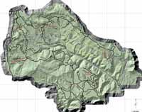
| Click on the above photo for a larger map |
A public meeting was held by the US Forest Service to explain a recent study of and recommendations for the Muddy Creek Drainage. Mesia Nyman said, “We want the public to know that this is merely an analysis and does not represent the proposal that the forest service will make. This study was done and these recommendations are what the specialists who completed the study are recommending.”
“Hopefully with a great deal of public input over the next few weeks, the forest service proposal can be developed and begin the National Environmental Policy Act process by the end of February 2005,” she stated. “Many of the major users have already been notified and asked for comments, but the general public has valuable opinions also. What we want is to have those comments.”
Matt MECCAriello presented the document detailing the study. All roads and trails in the Muddy Creek drainage have been analyzed for five risks and two values. The risks analyzed were: archaeology risk; engineering risk; threatened and endangered species risk; aquatic resource risk; and wildlife risk. The values assessed were the recreational use value and the resources management value. Each road was also measured for length, functional class (arterial, collector, or local), maintenance levels and costs. The entire analysis was based on the findings of risk and value of each road and trail.
This project by the forest service is the beginning of a process to build a new travel plan for the forest service managed lands. Following the conclusion of this project, another portion, probably North of the Muddy Creek drainage, will begin the management plan process.
One road where there is a cause for concern is the Spinners Road which is a popular destination. Back in the 90s the road was re-signed to a 52 inch trail and full-sized vehicles are not allowed. Those on the Sanpete side maintain that this resignage of the trail was done illegally and that full-sized vehicles should be allowed. They maintain that the trail was built by Jeep vehicles and that those vehicles should be allowed to use it today, and the closure was not put through the proper processes.
The Rim Trail and Lower Rim Trail offers 13 miles of single track recreation and has high recreation value and it is recommended this remain open. One road on the lower Muddy has upset some people with its recommended closure. This is not a loop trail, but leads to a dead end.
| Blacks Fork trail is number 95 on the Arapeen Trail system. Four wheel drive enthusiasts want this route reopened to full-size vehicles. Others prefer it as an ATV motorized trail. Differing viewpoints exist among the public. |
The analysis was well received by the public and viewed as reasonable.
At a recent Emery County Commission meeting, Mark H Williams from the Southeastern Utah OHV club spoke about the proposed closure of the road up the bottom of Muddy Creek, number 042 on the analysis map. He said the trail should be kept open to allow people to access the fishing on Muddy Creek, where small fish are caught. Derris Jones from the Division of Wildlife Resources said they could support keeping the trail open if the ATV club was willing to help with trail maintenance and culverts in appropriate places. Williams said there is grant money available for such trail projects.
In Utah not many trails are designated as single track motorized. There are single track nonmotorized which includes mountain bikes, hiking, foot and horse traffic.
The Muddy analysis is not in a formalized NEPA comment period, but the comments being gathered will help formulate a final document which will need to go through the NEPA process. The project area contains several miles of ATV trails.
Following the mapping and computer modeling of the area, the specialists were given the information for verification. Anyone familiar with the Muddy Creek Drainage is encouraged to respond with comments and ideas. All comments must be documented either in writing or by email. MECCAriello stated that if anyone has questions or concerns about the maps or charts, they are welcome to call him at the forest service office in Ferron, 435-384-2372.
All of the maps and charts may be viewed at the office in Ferron or on the website: http:://www.fs.fed.us/r4/mantilasal. Once at the website, click projects and plans, then road analysis, then Muddy Creek drainage. Comments and concerns are due by Jan. 30, 2005.
An additional public comment and information meeting will be held at the Centerfield Town Hall, in Sanpete county, on Dec. 15 at 6:30 p.m.

