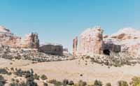
The Price Field Office released the final decision on the route designation plan identifying which off-highway vehicle roads and trails will remain open and which ones will be closed on one million acres of Bureau of Land Management lands centered around the San Rafael Swell. The decision was released on Feb. 3.
BLM’s Price Field Office Manager Patrick Gubbins described the plan and the years of toil and debate leading up to its completion as a grueling but necessary process�worth the investment in collaboration. “We have a solid decision that strikes the appropriate balance between a desire to maintain traditional access and the need to protect a very special public land treasure,” said Gubbins.
“Now that we have a final decision it’s time to re-focus our collective energies and make this off-road travel system an on-the-ground reality.” Although the final plan is still subject to appeal and lawsuits, Gubbins remains guardedly optimistic that interest groups will resist from trying to throw up roadblocks to delay implementation. “It’s time to work together and cooperate, not litigate,” he said. The plan is open for appeals for 30 days.
Under the plan, 677 miles of secondary OHV routes will remain open to maintain a diverse network of motorized vehicle routes accessing out-of-the-way viewpoints and the lesser-known destinations favored by seasoned explorers of the region. Rugged trails, loop trip opportunities and a small network of single-track motorcycle trails are also part of the open route system.
“Access really isn’t at issue here,” said Gubbins. “When you combine this comprehensive system of open OHV routes with the BLM and County Class B road systems�the primary paved, gravel and dirt backcountry transportation grid which is beyond the scope of BLM route designation�you have more than 2,000 miles of roads and trails available for work and play in the San Rafael area.”
The final plan closes 468 miles of secondary OHV routes. The majority of these are duplicate routes, dead-ending spurs, and routes that exacerbate the problem of “route proliferation.”
Other routes were closed to reduce user conflicts and protect sensitive resources. Some of the more high-profile closures include access into Muddy Creek through the Reef and Junes Bottom.
| Click on photo for larger version of photo |
The Upper Little Wild Horse trail will also be closed until safety problems are fixed.
The protection of wilderness study areas (WSAs) and areas of critical environmental concern (ACECs) figured heavily into the final decision. Vehicle routes closed under emergency orders issued in 1992 and 2000 to protect endangered plants and prevent wilderness impairment in six WSAs, remain closed. The plan also maintains the status quo by continuing to allow use on four inventoried ways in the Sid’s Mountain WSA as long as wilderness impairment does not occur. According to Gubbins, monitoring shows that the condition of the Sid’s Mountain WSA has improved. “It’s due to better signs and increased patrols, but the biggest factor by far and away, is user compliance.”
Remarking on how this success story could translate to the larger challenge of route designation in the San Rafael, Gubbins said, “Given sufficient resources and cooperation from the OHV community we can make it happen, step by step, over time.” But he cautioned, it will take a lot more of both to get us where we want to be.
As a first installment, BLM will use a combination of increased law enforcement presence, enhanced signing, and new maps. Law enforcement strategies will include a “task force” consisting of rangers from neighboring BLM field offices and supplemental patrols using State Park and Division of Wildlife Resources law enforcement officers during Easter and other high use periods. The most promising development to supplement the sole BLM ranger assigned to the Price Field Office is a newly proposed cost share arrangement between the BLM and the Emery County Sheriff’s Office that would add a deputy to patrol the San Rafael area on priority basis.
Increased regulatory and navigational signs will be installed to enhance safety, enjoyment and compliance with OHV regulations. Individual vehicle routes will be signed open or closed. Information bulletin boards strategically located throughout the region have been retrofitted with new maps and other useful information. Site rehabilitation projects will continue as volunteer labor becomes available.
A new OHV map showing the open designated routes is available on the Internet. This map can be reviewed at the BLM State Office in Salt Lake City and at BLM Offices and county offices, libraries and state parks in Emery and Carbon Counties. A limited number of maps are currently available from the Price Field Office (125 South 600 West Price, Utah 84501, 435-636-3600) until a larger shipment of printed maps is received in April.
The BLM has posted the San Rafael Route Designation website http://www.ut.blm.gov/sanrafaelohv. The site is filled with maps, photographs and detailed travel information.

