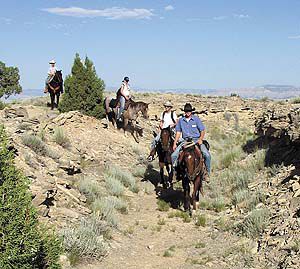
| The Old Spanish Trail traverses much of Emery County. |
The old west still holds much allure for many Americans and various projects help keep a bit of history alive. The history of the Spanish Trail is well worth preserving and representatives from the National Parks Service and the Bureau of Land Management met with local government leaders and interested citizens in Green River April 19, to explain the National Historic Trails project, and to gather public input.
In December 2002, Congress decreed that the Old Spanish Trail be designated as a National Historic Trail. So far, 16 different trails across the United States have been recognized by Congress and awarded NHT status. Each is considered to have special significance in the history of our country.
The official congressional recognition affords special considerations for the Old Spanish Trail, and a planning team representing both the BLM and NPS was recently put together to gather information for a comprehensive management plan for the trail. The BLM and NPS will jointly plan and administer the trail project.
Part of the planning process is a series of 21 public meetings in six western states bisected by the trail. Three meetings were held in Utah, one each in Moab, Green River, and Cedar City.
NHT designation for the Old Spanish Trail could have far-reaching impacts for Carbon and Emery counties in the years to come, depending on how the management plan is developed and implemented. Emery County will be most directly affected. The Old Spanish Trail made a wide arc across Emery County.
The Old Spanish Trail was active from about 1829 until shortly after the Mexican War of 1848. The route originated in Santa Fe, N.M., and ended in Los Angeles, Calif. It was a pack trail, traversed only by horses and mules. Spanish traders in Santa Fe formed annual caravans of merchants who traveled the trail together for mutual protection and support.
The trail crossed the Colorado River at Moab, crossed the Green River just north of the present town site, and then crossed Buckhorn Flat to a point near Castle Dale. From Castle Dale it followed the route of SR-10 to Ivie Creek, and then went west over Salina Canyon.
Few physical traces of the trail remain today. The route can be determined only through historical records and journals kept by travelers. Modern roads cover most of the original trail.
At the scoping meeting in Green River, officials from the BLM and NPS gave a quick overview of the trail itself, and then listed what were called five planning issues, concerns, and opportunities. They are:
| Very few of the old signs remain. Emery County has plans to erect new signs to mark the trail. |
A need to define the trail and its resources.
Identify opportunities for education, interpretation, and recreation.
Include all cultures and ethnicities in telling the story of the trail, to include Hispanics, Native American, and Anglo-Americans who used or were impacted by the trail.
Identify how protecting the trail will affect other land uses, and how other land uses will affect the trail.
Identify economic opportunities related to recreational use of the trail.
After briefly outlining the five points of consideration, the facilitators asked for public comments.
Emery County Commissioner Gary Kofford presented a letter from the Emery County Commissioners that outlined the county’s official position on the trail. In the letter, the commissioners expressed appreciation for the government’s interest in the trail, and mentioned that Emery County has made efforts since the 1950s to identify and interpret the trail.
The letter said that the outcome of the government scoping meetings should reflect the past efforts and concerns of the local communities, residents, and governments.
It further stated that any national planning should be consistent with local plans, both concerning the trail and adjacent land, regardless of ownership. The commissioners expressed concerns about land use policies mandated at the national, or even the regional level. “�what is determined to be in the best interest on the larger scale in the past, has had some very harsh impacts to local communities and land users. Ninety-two percent of Emery County is public land. Land use plans affect the very livelihood and economic well being of many residents, therefore we are greatly concerned with public land use planning in all forms,” the letter said.
The commissioners ended the letter by asking to be included as a cooperating agency in the development of the Old Spanish Trail management plan.
There were about 50 people at the public meeting and the consensus was unanimous. Several people expressed concerns that designating the trail for special consideration might limit access to it or through it. Everyone who spoke asked that the trail be of little or no impact to existing land uses and access to the public lands.
A question was asked about how wide the designated trail corridor might be through Emery County, and if things like scenic vistas would be considered in the management plan. The government officials were unsure.
“Are you planning to close the existing dirt road and open it only to backpackers?” someone asked. “Are you going to close other roads so this road is less impacted?” asked another. “We all saw what a mess the Burr Trail project turned out to be,” stated Richard Beardall. “Are we going to suffer through something like that again?”
The government officials reminded everyone that planning is still in the development stage and no decisions have been made yet.
| The Old Spanish Trail traverses much of the Emery County desert landscape. |
Bill Howell, Executive Director of the Southeastern Utah Association of Local Governments, said that he was leery about the terminology used for the project. “Words mean things,” he said. He pointed out that the project is being called a historic trail project and not a historic route project. “A trail is an undeveloped track through the sand,” he said. “I don’t like the sound of it.”
He also asked what the management plan would be managing. He pointed out that none of the government information is clear on that matter. “Do you intend to manage the trail, the corridor, the resources, or what?” Howell asked. He suggested that the government decide that important issue before the management plan goes any farther.
Commissioner Kofford stated that Emery County is prepared to fight if the management plan promises to impact energy development in the county in a negative way. He also expressed concerns about government restrictions on the use of public lands. “We already have many duplications and multiple layers of overlapping regulations imposed on us by various government agencies,” Kofford stated. “We don’t need anymore.”
The government agents facilitating the meeting said only that the plans are still in the development stage, and no final determinations have been made yet.
The trail covers 2,700 miles from New Mexico to California, and according to the NPS officials, ownership of the land the trail traverses is almost equally divided into three categories. One-third in private ownership, one-third on BLM lands, and one-third owned by the National Forest Service.
In response to Kofford’s concerns that local management plans might be ignored, BLM official, Sarah Schlanger, said, “This trail passes through 32 local management plans in six states, and we now know that we can’t write a plan to serve everyone.” She said she expected the final plan to be very general in nature.
The timetable for the Old Spanish Trail management plan is as follows:
Jan.-May 2006: planning efforts announced and public meetings held.
Summer 2006: Develop preliminary range of alternatives.
Fall-winter-spring 2006/2007: prepare draft plan/environmental impact statement/ internal agency review.
Fall-Winter 2007/2008: public review of draft/environmental document and analysis of public comments.
Spring-Summer 2008: prepare final document for department decision.
September 2008: release record of decision to the public.
Government officials will be taking public comments about the trail plan until May 17. Interested persons may phone, fax, or email comments. Written comments should be addressed to Sarah H. Schlanger, New Mexico BLM, P.O. Box 27115, Santa Fe, NM 87502. The phone number is 505-438-7454. Fax number is 505-438-7426. And the E-mail address is Sarah_Schlanger@blm.gov.
There is a national organization called the Old Spanish Trail Association, and they will be meeting in Green River on June 9, 10, and 11, at the John Wesley Powell Museum. The theme for the event is “Scoping and Interpreting the Old Spanish Trail.” The public is invited to attend. More than 200 reservations have already been made.
The event will feature an evening reception on Friday, followed by a symposium with discussions, featured speakers, and short field trips on Saturday. On Sunday the association will sponsor a field trip from Green River to Castle Dale, following the Old Spanish Trail route. The tour will end at the Museum of the San Rafael in Castle Dale, which will be opened for the event.
Information about the Old Spanish Trail Association and the upcoming event can be found on the worldwide web with a quick Google search, or contact the John Wesley Powell River Museum in Green River for information about the symposium.