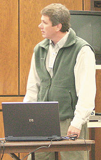
| Bret Dixon from the Division of Water Rights talks about Grassy Trail Dam at the DOGM meeting in Castle Dale. |
The Emery County water users, the Division of Oil, Gas and Mining and Emery County coal operators, and the water rights group held their quarterly meeting at the Emery County building recently. Susan White from DOGM conducts the meetings and after a round of introductions, Bret Dixon from the Division of Water Rights gave an overview of the Grassy Trail Dam and Reservoir. This reservoir above East Carbon has been under strict monitoring since coal mining in the area was nearing the dam.
The dam is in Whitmore Canyon and is a multi-zone earth embankment. The dam is 90 feet high. It supplies the culinary water to Sunnyside and to East Carbon. Mining was the closest to the dam last February and has since moved away from the dam. The west abutment settled six inches and one inch of settlement on the east. This settlement was well below the minimum allowed by law.
Part of the criteria and management of Grassy Trail was based on studies done with coal mining in relation to the Joe’s Valley dam. A magnitude of anything higher than 3.9 in seismic activity would not be allowed.
On the Grassy Trail dam a sluffing of 10 inches occurred along with six inches of subsidence, for a total of 16 inches or 1.3 feet.
The extensive monitoring included the placement of 16 pezometers throughout the dam and its foundation. Seismic events were recorded as the mining moved closer to the dam and throughout the time when mining moved away from the dam. Dixon reported there were no surprises with the data collected from the pezometers. There wasn’t any water seepage from the dam. Any landslides were monitored. During the mining of panel seven which was closest to the dam there was some movement-seismic activity, but since October of 2007 that has flat lined out.
Dixon said in summary, ground shaking events were recorded during the mining of panels six and seven. Activity was greater during the mining of panel seven. The largest seismic event was 2.6 on the Richter scale and occurred on March 11, 2006. The dam was heavily monitored by the inspectors and inspected for cracking and movement on a weekly basis.
Jay Mark Humphrey from the Emery Water Conservancy District wondered what happened if there wasn’t any surface expression of water. Dixon said the movement was into the dam with a rising or bulging effect. Monitoring still continues on the dam. The question was asked if mining damaged the dam in anyway. Dixon answered there was no evidence of stress to the dam. There was also no increase of water flowing into the mine at any point in the mining process.
The question was asked if the mine had affected the dam, what mitigation would be done? It could possibly end up in a court situation. The mine would have stopped mining in that area, if monitoring indicated there were any problems and the mining operation would have moved further away from the dam.
Dana Dean from DOGM reported on the discharge of water from the Crandall Canyon mine. Where stoppings have been put in there is water leaking around them and flowing out of the mine. It flows into Crandall Creek and into the Huntington River. The samples indicate that zinc and nickle in the discharge are over the legal limits, but are trending down. The mine needs to change its reclamation plan to include the water discharge. The total dissolved solids are now under compliance. The water quality is improving and the current discharge is about 600-700 gpm. Jay Marshall from UtahAmerican Energy said the flow has stayed the same from when the mine was operating to now when it is idle.
All parties were notified of the discharge so they could be alert for any possible flooding. It was determined that it is important to know where the water is coming from and if any streams have been affected. Dean said that DOGM will keep monitoring the water. The water has always been there, there is just a change now in its point of discharge. It was recommended that the water flow from Crandall Canyon be put as an agenda item for the next meeting in May and addition information be gathered to address the questions of the water users.
Dave Shaver from UtahAmerican Energy was concerned about the water flow and any affects it might have, he wrote a letter to all parties about two months ago alerting them of the problem.
Dean also gave an update on the water issues at Electric Lake. She said the discharge into Eccles and into Electric Lake has remained steady. The discharge into Eccles is slightly higher. Since late 1998 there has been a total discharge of 100,000 acre feet, more into Eccles. Indications point to Electric Lake being higher in wetter years and lower in drought years on a consistent basis. The storage in the lake is consistent with the water available in the drainage. Dean said Cody Allred from PacifiCorp will give a more complete rundown on the water situation at Electric Lake during the May meeting.