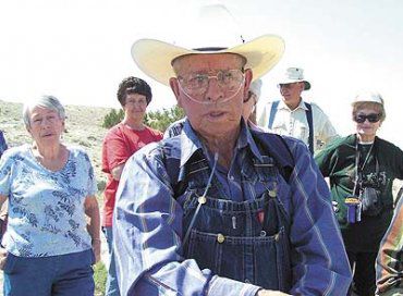
The Emery County Historical Society went on a trek to the Muddy Creek on June 8, led by Mervin and Gale Miles. The trek began at the Daughters of the Utah Pioneers Monument just west of SR-10 about two miles north of Emery by the Castle Valley Outdoors turn off. When the Historical Society arrived at the monument, they were greeted by a great number of gnats that continued to plague the group much of the morning. The inscription at the monument reads: Utah Pioneers Monument # 142 erected September 1949. Titled “The tunnel builders”.
1889. The pioneers had located on the Muddy Creek three miles North East of the town of Emery. Built in their poverty a tunnel 1,200 feet long through blue slate rock to bring water to the town of Emery. Their only tools were pick and shovel and blasting powder. They hauled dirt out in a two wheeled cart. They sank three shafts, one at each end and one in the middle of the blue slate hill, allowing for work in four directions. The pioneers used horse power to hoist dirt out in wooden buckets. Their living quarters were dugouts along Muddy Creek, called Camp Muddy Creek.
From the monument the group traveled along a dirt road to the top of the blue shale hill overlooking the irrigation canal that began as a tunnel engineered by pioneers in1885 and finished in 1889. Merlin Christensen told about the tunnel and how as a child he would skate on the canal into the tunnel in the winter. Merlin described how the pioneers attempted to shore up the tunnel with cedar posts along the wall and roof. Cave ins were frequent and they used a scraper on a long cable, pulled by a team of horses to clean out the tunnel.
By putting the tunnel through this blue slate hill the pioneers were able to get water to more fields at a higher elevation, than they would have if they had gone two miles around the hill resulting in a loss of water due to seepage and evaporation.
The Nielson Construction Company contracted for and did replace the tunnel with a deep ditch after a tunnel collapse in the 1940s.
The Muddy Creek farm land and some of the canyon is owned by Castle Valley Ranch and permission has to be obtained before going there.
The Muddy Creek settlement was on the West side of what is now State Highway 10.
Casper Christensen from Spring City homesteaded and started the Muddy Creek Settlement about 1881. At one time there were homesteads all along the Muddy Creek. A homestead consists of 160 acres. Most of these homesteaders started out living in dugouts. Later those that stayed built log cabins. In 1881 Casper was made Post Master of Muddy and in 1883 he was called to be the Bishop of Muddy.
For those wishing greater details about the Muddy Creek and its history read A History of Emery County by Edward A. Geary pages 103-106. One of the pioneer log cabins still standing is on what is called Jacobson’s Ranch. At the Jacobson Ranch cabin the group examined the cabin and the surrounding area. They were excited to find a coiled rattlesnake near the cabin. The old dugout of the Allred Homestead is so overgrown with grease wood that it is difficult to see or find.
The group went to the Minchey Cemetery where Gale Miles told about the Minchey family. She recalled visiting a school friend at the Minchey’s during the summer. The family of Jacob and Pleasant Minchey and heirs of the Minchey line are buried in the Minchey Cemetery.
Jacob and Pleasant Mincey cemetery existed from 1820 to 1900. The monument erected in 1950 lists all those buried in this cemetery.
From the cemetery to the West an outcropping of rock that looks like a temple can be seen. This rock outcropping has been given the name of Minchey’s Temple. As the Historical Society continued along the Muddy to where the water is diverted 80 percent to Emery and 20 percent to Moore they got to see the quality of water being used to irrigate and drink.
Mervin Miles then took the tour deeper into the canyon along the rocky cliffs and pointed out petroglyphs and pictographs. Field glasses were needed to see some of the rock art high on the cliff face. Near one pictograph of a mountain goat a large piece of sandstone was discovered that looked like the ankle, the foot and toes of a giant.
Mervin pointed out roads cut into the South and North walls of the canyon as the roads used by core drillers to determine the feasibility of building a dam in the canyon in the late 1960s and early 1970s. The idea for a dam came during the energy crisis in the 1970s. The water from the dam was to be used for a coal gasification plant to be built east of SR-10. Easier ways to extract the gas from coal and the price of gasoline coming down, were the main reasons the construction of the dam was abandoned.The trip along the Muddy Creek was a good adventure and about 1 p.m. the group decided they were ready to have lunch at the Emery Park. The lunch was a pot luck of salads and desserts.
Historical society learns history of Emery canal

"Merlin Christiansen tells the history of the Emery canal."
