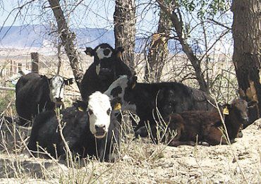
The Emery County Public Lands Council discussed grazing issues at their work meeting on Nov. 3. The council sent a letter to all permittees informing them of what the lands council is proposing in moving forward with a lands use bill in Congress.
The permittees have been asked to take a look at their grazing permits and see what’s in them. Ray Petersen, public lands director said there was a recent case where a permittee did some work on stock ponds and the BLM wasn’t aware of these stock ponds so it created some issues. Petersen said in order to avoid these types of conflicts the permittees must be diligent in recording all stock ponds, troughs, cattle guards and fences and any other improvements on their allotments. They need to document them and provide this information to the BLM.
Petersen said the county has taken a similar step with dispersed camping. The county has recorded and did the GPS work on dispersed camping sites and provided that data recorded on a map to the BLM.
Many of the permittees who have received the letters have contacted Ray Jensen at the BLM to go over their permits. Petersen displayed an Emery County map with the range improvements outlined. The IT department will also work to identify springs on the allotments as well. The permittees are being encouraged to GPS and record all improvements on their allotments so they can be added to the map. If the permittees don’t have the capabilities to do this, then they can contact the IT department and give a good description of where the pond is and the IT department can do the GPS work. Each of the dots on the map will correspond to a table which will give a description of the type of improvement.
Jensen said of the approximate 2,000 projects in Emery County, the BLM records only have documentation on one half to two-thirds of those. Their records are inadequate and not exact. In 1934, the BLM nationwide turned over basic range improvement projects to the permittees. The BLM still does seeding and chaining projects. The BLM manages to the Taylor Grazing Act.
Each permittee has a file with his allotment and AUMs on record at the BLM. The agreement in each file state the permittee will maintain all assigned range improvements and permit use is contingent on maintaining their assigned projects. The question arises on which ones are assigned? A list of projects for each allotment is needed.
Jensen said he knows there are more projects out there than are recorded. He encouraged permittees to get pictures and data concerning when each range improvement was made and when fences were built; this information will be added to their file. He said each permit is reviewed every 10 years and the BLM does a permit renewal where they evaluate the allotment and determine if the allotment is meeting management objectives.
Not all of the range improvement projects have roads to them. It’s important to document how access to the improvement is achieved and how each improvement is maintained.
Jensen said if a wilderness designation is enacted and no documentation to these improvements exists then the permittee may just be out of luck. If the projects are there and recorded then maintenance and access will be guaranteed. In the Price Resource Management Plan, the grazing section has tried to give latitude for the purpose of maintenance. The language in the RMP is vague specifically to protect and maintain existing projects as well as future projects. In the Price RMP grazers didn’t lose anything. The Price RMP is however in litigation filed by SUWA and other environmental groups.
The documentation of range improvements is important even if legislation is not pursued. Petersen said it is the intent of the lands council to stay along the guidelines of the Price RMP. The Price RMP is the current existing document by which the BLM lands within Emery County are managed. This language that governs grazing within the RMP doesn’t need to be repeated in the legislation.
Randy Johnson, Emery County lobbyist, said the resource committees don’t allow language that is redundant, but, you can place references within your document, in regards to what is out there. The major objective is to carefully design the wilderness area that avoids conflicts so there are no questions when the legislation passes.
Jensen said it’s important not to lock yourselves into existing projects, but to plan for future needs and projects, too.
Wayne Ludington from the BLM said it’s great the lands council wants to help the BLM record all the improvements, but along with that comes increased paperwork for the BLM and all these projects will need to be identified and recorded according to BLM protocol. The BLM can’t just automatically add those projects to their records.
Gary Petty, lands council member said in dry years, some of the springs don’t run and water is hauled into the cattle and he would like to see this allowed within a land use bill.
Jensen said the BLM will work with permittees to determine which of their projects are worthwhile and worthy of maintaining.
Sherrel Ward, council member asked what the grazers need to do to get these projects on their allotments recorded. Jensen said right now the BLM priority is the permit renewals.
Public lands council discusses grazing allotments

"Grazing is discussed at the Public Lands Council."
