The Emery County Public Lands Council is moving forward with their land use bill. After two years of steady work the draft language is nearing its completion. The lands council met and went over the draft land use bill number four at their January meeting. Areas of concern were addressed and Ray Petersen, public lands director noted the changes and will incorporate them into the draft document.
After the changes have been made the bill in its draft form will be sent to Washington to the Washington delegation where the bill will be written in proper bill form. When a final bill becomes available the bill will be brought back to the people of Emery County where open houses will be held to allow people to peruse the bill in its final form. Lands council members pointed out this will not be the time for changes in either language or maps unless there is something which has been overlooked in the process concerning language or maps. The maps will be the defining document when it comes to the land use bill. The land use bill will outline what types of uses are available in a particular area. Along with acreage for wilderness designation the land use bill proposes establishment of two National Conservation areas.
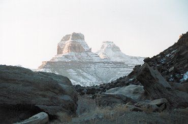
Areas the lands council has outlined for addition to the national wilderness preservation system include: Crack Canyon wilderness as outlined in the Crack Canyon Wilderness map. Desolation Canyon as outlined in the Desolation Canyon Wilderness map and managed by the Bureau of Land Management. Devil’s Canyon acreage depicted on the Devil’s Canyon Wilderness Map. Horseshoe Canyon North; Mexican Mountain; Muddy Creek; San Rafael Reef; Sids Mountain and Turtle Canyon will all be presented for wilderness status. These additions to the wilderness system are subject to valid and existing rights including roads, grazing, water, etc. Each wilderness area will have a map and legal description. In reference to management of these wilderness areas, they will be subject to valid and existing rights and shall be administered by the Secretary of the Interior in accordance with the wilderness act. The grazing of livestock in each area designated as wilderness where established before the passing of this Act shall be permitted to continue subject to reasonable regulations, policies and practices.
The livestock representatives including Sherrel Ward and Mistie Christiansen, lands council members have worked on the language to be included so livestock grazing can continue unimpeded within these newly created wilderness areas. The language stipulates that permittees will be allowed the ability to utilize motorized access to maintain fences, ponds, troughs, springs and to retrieve wounded, crippled, sick or restricted animals needing assistance due to weather or other circumstances.
Wildfire, insect and disease management will still be allowed in these wilderness areas. These proposed wilderness areas do not include any buffer zones. Military fly-overs of wilderness areas are not restricted.
Any land located within the wilderness area that is private or owned by interested sellers can be purchased or exchanged or donated. Any land acquisitions shall be incorporated into the wilderness area. All tribal rights will be retained in a wilderness area. Any climatological data collecting will be allowed. Wilderness designation shall not affect valid and existing water rights. Management of fish and wildlife shall be allowed in the wilderness areas. Predator control measures will be allowed. Wildlife water development projects including structures and facilities will be allowed.
Another important point in the Emery County land use bill is the release of any lands within the current Wilderness Study areas that are not designated as wilderness in the Emery County land use bill. Any public land that is not designated will no longer be subject to the Federal Land Policy and Management Act of 1976 and shall be managed in accordance with applicable law and the management plans adopted under section 202 of that Act. The BLM land in Emery County is governed by the Resource Management Plan developed by the Price Field Office. Lands not designated as wilderness will be managed by the current RMP in place by the BLM.
Search and rescue will be allowed in wilderness areas as well as the maintenance of communication sites and utility corridors.
Another aspect of the Emery County Land use plan is the development of National Conservation Areas. One proposed NCA is the San Rafael Swell, Western Heritage and Historic Mining National Conservation Area. The purpose of this section is to conserve, protect and enhance for the benefit and enjoyment of present and future generations the scenic, wildlife, recreational, including motorized and mechanical, cultural, historical, natural and educational resource of the San Rafael Swell, Western Heritage and Historic Mining National Conservation Area. A comprehensive plan shall be developed for the management of this NCA. An advisory committee will be established to write and implement the plan for the long term management and protection of the NCA. This advisory committee shall be 12 members and four are to be appointed under the recommendations of the Emery County Commission. Four under the recommendation of the State of Utah and four to be recommended by the Bureau of Land Management Utah State Office.
Another NCA being considered is the Wild Horse Mesa National Conservation Area and will be managed in accordance with its own management plan and advisory council set up in the same way as the San Rafael Swell, Western Heritage and Historic Mining National Conservation Area.
Another part of the Emery County land use plan is the comprehensive travel and transportation management plan. The plan comes with a map outlining all modes of transportation systems within Emery County including: Federal Interstate Highways, Utah Department of Transportation Highways, BLM roads and trails including the Elliot Mountain road, BLM designated routes as identified in the Price Field Office RMP of 2008. All forest service system roads. MLNF motorized trails, city and county class A, B and D roads; Emery County motorized trails, federal, state and county non-motorized trail; unauthorized roads and routes which provide access to dispersed camp sites; Huntington Airport, Cedar Mountain Backcountry Airstrip, Hidden Splendor Backcountry Airstrip, Mexican Mountain Backcountry Air strip.; All existing routes east of SR-6 and east of SR-24; future OHV rote from Carbon County line to Quitchumpah, west of communities; Junes Bottom Road; seasonal OHV route from Hidden Splendor Mine Airstrip along Muddy Creek to EM1013; Mexican Mountain Road to river; Sids Leap Road to end of road; the Green River.
In the land use plan, recreation shall be managed consistent with the Price Field Office RMP. Dispersed camping shall be allowed without permit unless otherwise designated by the BLM. In areas which have wild and scenic river designation protective management will apply to BLM lands along suitable river segments with 29 miles tentatively classified as wild and 59 miles as scenic and eight miles as recreational. These river segments include Chandler Creek to Florence Creek, scenic, in Desolation Canyon; closed to OHV and oil and gas leasing unavailable. Florence Creek to Nefertiti boat ramp, designation-wild Desolation and Gray Canyons; oil and gas leasing unavailable and closed to OHV. Nefertiti boat ramp to Swasey’s Beach boat ramp-classified as recreational; oil and gas leasing unavailable and closed to OHV. The confluence of the San Rafael River to Canyonlands National Park, suitable for scenic is limited to designated OHV routes.
As the draft document nears completion the acreage numbers for the wilderness areas and the National Conservation areas will be generated by the Emery County IT department. The map is nearing finalization.
Petersen said he has a meeting next week with the Washington staff members and he hopes to have them working on the Emery County land use language soon. The bill could be ready as soon as March or April or maybe not until June. The timetable isn’t known at this time, but Petersen estimates it will be ready to introduce to Congress somewhere between April and July.
County presses forward with land use bill
"Emery County hopes to have some say in public lands issues so they are pursuing the Emery County land use bill."